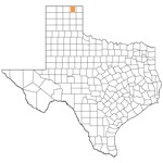
Ochiltree County Location
OCHILTREE COUNTY. Ochiltree County is in the far northern Panhandle, bordered on the north by Oklahoma, on the east by Lipscomb County, on the south by Roberts County, and on the west by Hansford County. The county is in the heart of the High Plains. Perryton, the county seat, is in the north central part of the county, 120 miles northeast of Amarillo. The area was named for William Beck Ochiltree, a Republic of Texas judge, secretary of treasury, and an officer in the army of the Confederacy.
The rich clay and loam soils support abundant native grasses as well as wheat, grain sorghum, corn, cotton, and alfalfa. Elevations range from 2,600 to 3,100 feet above sea level, and the county’s annual average rainfall is 20.48 inches. Temperatures range from an average minimum of 18 F in January to an average maximum of 93 F in July. The average growing season lasts 191 days.
Ochiltree County possesses a diversified economy centered around agriculture, oil, and gas. The agricultural sector earned $250 million in 2005, primarily through the production of cattle, hogs, wheat, sorghums, corn, and alfalfa. Irrigation, which began in the late 1940s and expanded in the 1960s and 1970s, is used on 30 percent of the county’s croplands.
Cattle feedlot operations, large scale commercial swine feeding, agribusinesses, and oilfield services also add to the local economy.
BIBLIOGRAPHY: Wheatheart of the Plains: An Early History of Ochiltree County (Perryton, Texas: Ochiltree County Historical Survey Committee, 1969).
Donald R. Abbe


